Overview

Namibia will enthral you with its otherworldly landscapes and elemental emptiness, with its barren, sand-swept coastline, its roaring sand dunes and vast canyon. Driving across the country, one realises that it really is one of the most sparsely populated countries on earth.

In the north, the country transforms with rivers and wetlands in the Zambezi Region (previously known as the Caprivi Strip) and the impressive Etosha National Park which easily positions itself as one of the elite wildlife-watching destinations in the world.

Visiting Namibia offers a world of possibilities and breath-taking adventures as you’ll see in this section. These are just a taste of what is available and our team here at Ikewana, who has experienced them first hand, will guide you all the way as you customise your Namibian adventure.

Namibia's Climate

As most of Namibia is covered by desert it is unsurprising that the climate is exactly what you would expect from a desert country. Daytime temperatures are hot (extremely hot in summer) and nights are cold, some areas frequently drop below freezing in winter. Rainfall is sparse; with the northeastern areas of Namibia getting the most rain (this area is tropical) and rainfall decreasing as you travel south and westwards. The Namib Desert runs along the coast and rain in this area is rare.

The rainy season in central Namibia starts in January and runs until the middle of April. Further north the rains begin earlier and as you travel south, the season becomes shorter. It’s fairly safe to say that if you travel in the winter months you will hardly see a cloud, except for the deep south where occasional (once every couple of years) winter rains do occur. Coastal Namibia is different; it only ever gets really hot in winter (when the east wind blows), almost never rains, and is frequently blanketed by fog.

  • Black Rhinos. Here you’ll find the world’s largest free-roaming black rhino population on communal land.
  • Etosha National Park Etosha National Park is a firm favourite, for its amazing biodiversity, great game viewing and black rhinos.
  • Plenty of space Namibia has a tiny population of around 2 591 042 despite its landmass covering almost the same area as France and Germany combined.
  • A photographer’s paradise Quite honestly, Namibia possesses some of the most awesome landscapes in Africa that are untouched by mankind.
  • Brilliant Stargazing at Gamsberg Due to the low population density, the very low air pollution and the virtually non-existing light pollution, Namibia offers ideal conditions to explore the southern night sky.
  • Much more than just sand The Namib Dune Sea, an area of 50 000 km2 within the Namib-Naukluft National Park, is one of the most sought-after tourist destinations in the country and a UNESCO World Heritage Site.
  • Safari by air Experience some spectacular views flying at low levels over the barren coastline of the Skeleton Coast by light aircraft with your own private pilot.
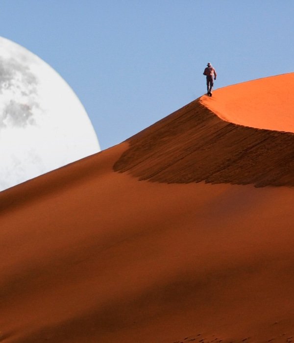
  • Big Daddy Trek to the top of Big Daddy at 325 m, which is the tallest dune in the Sossusvlei area, or drift over it in a hot air balloon.
  • Sunshine Namibia has an average of 300 days of sunshine annually making it one of the sunniest countries in the world.
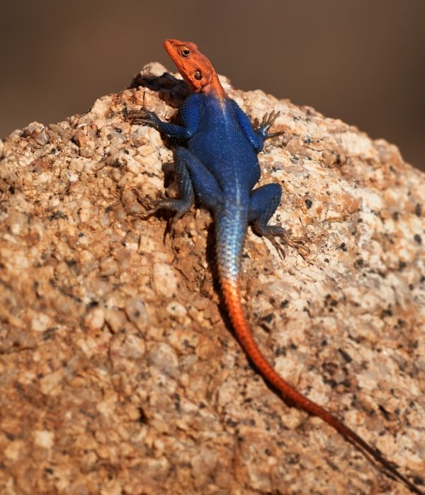
  • Extremely high levels of endemism Namibia boasts numerous mammals, birds and reptiles found nowhere else on earth.
  • Sustainable tourism at its best The country is of the first worldwide to incorporate environmental protection into its Constitution, resulting in community-based initiatives that provide social and monetary benefits to the communities and of course an authentic experience for you the visitor.
  • Largest Cheetah population in the world Namibia’s efforts at achieving a balance between environmental conservation and the livelihoods of human beings have resulted in successfully leading global efforts at protecting this endangered and magnificent cat.
  • Capital: Windhoek

    Currency: Namibian Dollar (NAD). Both Namibia and South Africa are part of the Common Monetary Area, which means that the Namibian Dollar (NAD) and the South African Rand (ZAR) are valued 1:1. It also means that you can freely use both NAD and ZAR in Namibia, but the NAD cannot be used in South Africa. That is important to know if you are travelling to both countries.
  • Language: English (official; 7%); Afrikaans and German, as well as indigenous languages: Setswana, Lozi, Oshiwambo, Otjiherero, Rukwangali, Damara.

    Electricity: Current is 220 / 240 volts at 50 cycles per second. A three-point round-pin adapter plug should be brought for your electrical appliances and can be bought at most major airports.
  • Airports: The main airport, Hosea Kutako International Airport (WDH) lies 28 miles (45 km) east of Namibia's capital, Windhoek. Besides Air Namibia, which is the national airline and serves destinations in South Africa and Europe, there are major airlines that fly into Windhoek and Swakopmund. Other destinations can be reached by car or charter flight.

    When to go: To begin with Namibia has two seasons, austral summer (November to April) - also known as the rainy season, and austral winter (May to October) - also known as the dry season. Any time of the year is a good time to go to Namibia, but most visitors prefer to travel during the months from April to October when the weather is a little cooler. The average daytime temperature is 20 degrees celsius inland. At this time, it hardly ever rains and the visitor can enjoy the uninterrupted sunshine and avoid the intense heat. Nevertheless, temperatures can reach freezing or close to it at night, so warm clothing is necessary, particularly for campers. This is also an ideal time for game viewing as the vegetation is receding and drying out, causing the animals to visit permanent water holes. Layered clothing is recommended for early morning game drives and night drives - so that one may add or take off layers to remain comfortable. Along the coast it is cool with mists at this time, so for this area travel is best from November to February. Rainy Season: The main rains in Namibia occur between January and March and during this time one may encounter brief afternoon downpours (usually an hour or so). These are more intense in the Northern regions of the Zambezi Region (previously known as the Caprivi Strip), Kunene and Ovamboland, but heavy prolonged showers can also be experienced through most of the interior. Humidity can be high during periods of high rain, particularly in the north. Flooding during this period is common in the Zambezi Region and along the Kunene River so it is important to check with your lodge before departure in case of any necessary diversions. During the rainy season, temperatures average 30 degrees celsius, but it is not uncommon, particularly in November, January and February, for temperatures to reach the mid-40s, so air-conditioning in your vehicle is essential for travel at this time of year. At night, temperatures do fall but not to an unpleasant level. At the coast (Swakopmund, Luderitz, Skeleton Coast) rain is uncommon even in rainy season. The temperatures are generally much cooler than inland. The summer months are hot in Namibia and Namibians like to move to the cooler coastal towns, preferably to Swakopmund. Here, they can expect sea fog in the mornings, which keeps temperatures down. The fog usually dissolves around midday. Windhoek is also bearable in summer due to its altitude of about 1 650 m. However, the Namib regions should be avoided in summer when temperatures climb to over 40°C. The same applies to the tropically humid north-eastern regions - especially the Zambezi Region.
  • Getting Around: Public transport in Namibia is of little use to the traveller as most of Namibia’s tourist attractions lie spread out across the country. In order to see them, visitors will have some pretty long driving distances. Around 80% of the roads in Namibia are either hard gravel roads, sand roads or salt roads, making fast driving not as safe as your normal highways. The maximum advisable speed on these roads is 80 km/hour. Having said that, it is easy to travel around Namibia by car, and a 2WD vehicle is perfectly adequate for most journeys. Long distances, poor mobile phone coverage outside of main towns and infrequent petrol stations that only accept cash, mean that planning ahead is vital. Namibians drive on the left-hand side and all signposts are in English. The general speed limit is 120km/h on tarred roads outside of towns and 60km/h in built-up areas. On a final note: Namibia is the only country in Southern Africa that implements daylight savings. The clock is turned back by an hour to GMT+1 on the first Sunday of April, and 1 hour forward to GMT+2 on the first Sunday of September. It is important to keep track of this when planning your trip.

    Area: Namibia has a total land area of 823 290 km2 (317 874 sq. miles) which is roughly twice the size of Germany. The country is bordered by Angola and Zambia (north), Botswana (east), South Africa (south), and the Atlantic Ocean (west). The population density is very low amounting to 2.4 inhabitants per square kilometre and the main reason for this is the harsh desert and semi-desert conditions and the resultant scarcity of surface water. With the exception of the border rivers - the Orange in the south and Kunene, Okavango and Zambezi in the north - there are only dry rivers in Namibia. These so-called "riviere" only flow periodically during the rainy season and sometimes just for a few days or even hours.

    What to wear: In general, Namibians have a somewhat relaxed attitude to dress codes, so a jacket and tie is highly unusual. For a formal occasion or work wear, long trousers and a shirt with buttons are quite adequate. Alternatively, a pair of sensible shoes, jeans and a t-shirt are recommended. When packing, due to the heat, keep your selection of clothes lightweight and loose-fitting, made from natural fabrics such as linen or cotton. These will keep you cool and are easy to wash and dry. Interestingly enough, avoid blue clothing as the pesky tsetse flies are drawn to the colour blue, and their bite can give you African Sleeping Sickness. Long-sleeved shirts and long trousers will protect you against mosquitoes at night.
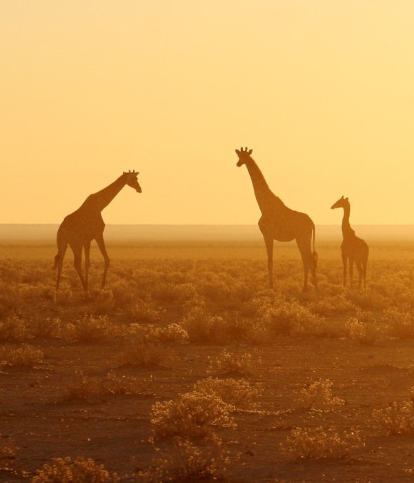
  • Etosha The Etosha National Park is situated in the northwestern part of the country and is renowned for its world class game viewing. It is centred around the vast Etosha salt pan, which covers 23% of the surface area of the park, and is so large that it is even visible from space. The salt pan is usually dry and only briefly fills with water after the seasonal rains fall. This is enough to stimulate the growth of a blue-green algae which lures thousands of flamingos and makes for a wonderful sight. Most of the wildlife, including herds of zebra, wildebeest and antelope, can be seen around the waterholes bordering the pan.

    Swakopmund Swakopmund is a popular beach resort for Namibians on holiday and is the heart of the Skeleton Coast tourism area. It is often described as being more German than Germany and with its colonial buildings is reminiscent of a time when it was the main harbour for German South West Africa in the late 1800s. There are plenty of exciting things to do there, including sand-boarding, horse-riding, quad-biking and paragliding.

    Cape Cross Observe the Cape Fur Seal colony at Cape Cross - a beach and breeding reserve located 120 km north of Swakopmund. It is home to one of the largest colonies of Cape Fur Seals in the world with around 100 000 seals. The seals have a thick layer of short soft fur, which is protected by a layer of longer, harder hair. Even though the top layer gets wet, the bottom layer stays dry. In combination, the bottom fur layer and the fat formation under the skin give the seals a good isolation against the cold Benguela current

    Damaraland Damaraland with its exceptionally scenic landscape, which features open plains, ancient valleys and spectacular rock formations, is a wonderful place to visit. The major attractions besides the world-famous ancient rock art, are the sacred Spitzkoppe, the Brandberg, Twyfelfontein, Vingerklip and the otherworldly Petrified Forest. If you’re lucky you might see the rare desert-adapted elephants. The area also hosts Africa's largest population of free-ranging rhinos (rhino tracking is a real highlight here).

    Kolmanskop Kolmanskop is an eerily beautiful ghost town in the Namib Desert, and located ten kilometres inland from the port town of Lüderitz. Once a prosperous diamond town where many Germans settled, the town had all the amenities including a hospital, ballroom, school and casino. Then when a richer diamond area was discovered further south, it was abandoned. Since then, the town has battled the harsh natural elements and today tourists walk through houses knee-deep in sand. It’s a photographer’s paradise.

    Sesriem Sesriem Canyon is a natural gorge which was carved millions of years ago by the once mighty Tsauchab River. The Canyon is one of the few places in the area that holds water all year round. Its name translates as "six belt" referring to the six belts, usually made of Oryx hide, that a thirsty settler would have to tie together in order to reach down into the deep hollows in the canyon floor to extract the crystal clear cool water which collects below the canyon’s floor.

    Twyfelfontein Twyfelfontein is a UNESCO World Heritage Site and famous for one of the largest concentrations of rock paintings and engravings (Petroglyphs) of the San (Bushmen) in Africa. What is remarkable is that the engravings were made without the use of metal tools and that amongst the motives of hunting scenes, in which hunters are pictured with bow and arrow, are many animal engravings (antelopes, zebras, giraffes, lions, etc.) and a seal. The ocean is about 100 km away.

    Kaokoland Kaokoland is a vast, beautiful and harsh area with dry riverbeds and wide open plains that are traversed by desert adapted elephants. These elephants have uniquely adapted to their arid environments, most notably in their thinner bodies and wider feet. The larger size of their feet allows them to walk with more ease across the very soft desert sand, which is useful when you consider the fact that they have been known to travel up to 200 kilometres (124 miles) in search of water. Kaokoland is also home to the remarkable Himba people, a tribe of 13 ethnic groups living in Namibia. The Himba tribe became internationally most famous for the red ochre the women apply to their skin, as well as the way they plait their hair in elaborate arrangements of leather, mud and the tufts of oryx tails.

    Walvis Bay Walvis Bay is the third largest town in Namibia and the country’s only deep-sea harbour. A pleasant alternative to Swakopmund, the city offers boat trips to view dolphins and seals (and on occasion whales). It’s a great base for bird enthusiasts and a visit to Sandwich Harbour is a must, with its natural lagoon and birds in excess of 120 000, including pelicans and flamingos.

    Bushmanland Bushmanland, which is situated in the north-eastern part of Namibia, is well known for its spectacularly scenic and rugged terrain. It is home to the last true San who are the earliest known inhabitants of Southern Africa. The San, a diverse group of hunter-gatherers, had an incredible knowledge about surviving harsh conditions with hardly any other means than what they would find in nature. A visit to a local community to learn about how their ancestors used to survive the Namibian Desert, will make for a culturally rich and memorable experience. (The San were also referred to as Bushmen, but this term has since been abandoned as it is considered derogatory).
  • Sossusvlei Sossusvlei, with its iconic red sand dunes, is one of the premier attractions in the country. It is located in the Namib-Naukluft National Park and consists of some of the highest sand dunes in the world. The sand here is around 5 million years old and owes its colour to the iron oxide content. Photographers are rewarded with amazing views in the early morning or evening light, when the dunes seem to come alive. Climb Big Daddy (the highest in the Sossusvlei area at 325 metres) or the less strenuous Dune 45 (only 85 metres high). A visit to Deadvlei, located closeby, is a must. This photographer’s playground consists of a clay pan characterised by dark, dead camel thorn trees contrasted against the white pan floor. The pan was formed when the Tsauchab River flooded and the abundance of water allowed camel thorn trees to grow. When the climate changed and the sand dunes encroached on the pan, the river was blocked from reaching the area. The trees are approximately 900 years old and have not decomposed due to the dry climate.

    Fish River Canyon The Fish River Canyon in southern Namibia is a spectacular geographical phenomenon and cuts an impressive 161 km long gorge into an otherwise flat landscape. It is second only in grandeur to the Grand Canyon in Arizona. It is up to 27 km wide and in places almost 550 metres deep. For those who like a challenge there is the option to do the 85 km hike, which is only open during the winter months. It usually takes around 4 days to complete and afterwards a visit to the relaxing Ai-Ais hot-springs to relax your weary body is advised.

    Spitzkoppe Spitzkoppe is often called the “Matterhorn” of Namibia and consists of two mountains. The highest peak rises about 700 metres (2 300 ft) above the flat desert floor. For hikers and mountaineers the Spitzkoppe is a paradise, but the ascent of the challenging west side something is to be reckoned with.

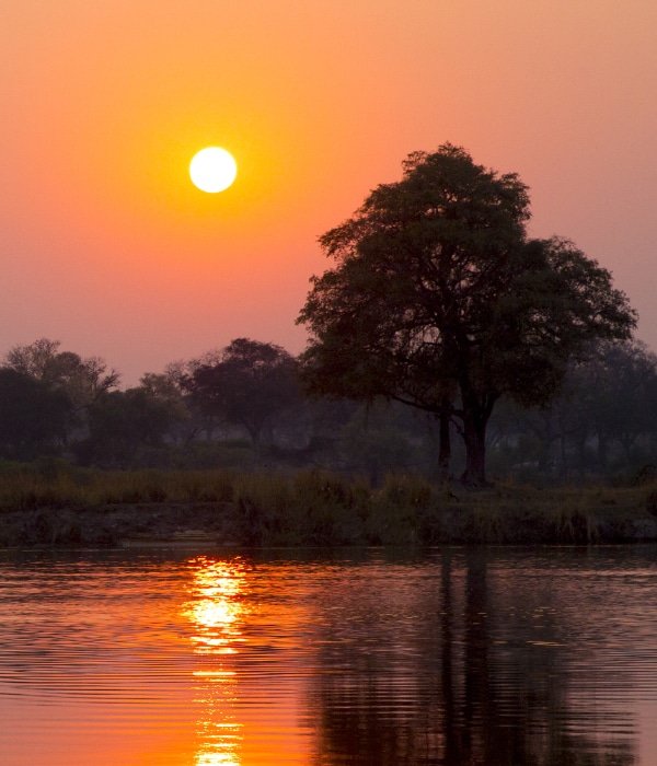
    The Zambezi Region The Zambezi Region (previously known as the Caprivi Strip) which borders Angola, Botswana and Zambia, is a mosaic of woodlands, forests, swamps and rivers and home to an abundance of game and birds. It is the wettest region in Namibia and this abundance of water sustains a large variety of animals, including a large population of elephants. The wildlife are protected in four reserves, but as there are no fences; the animals roam freely across international borders.

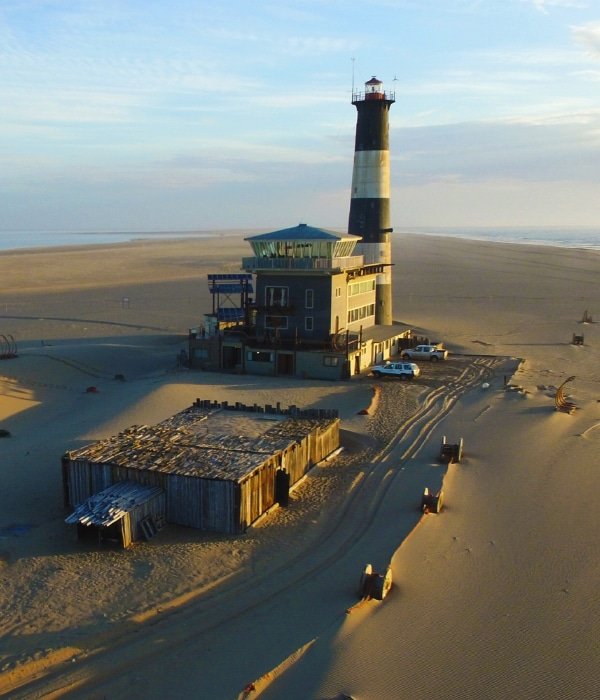
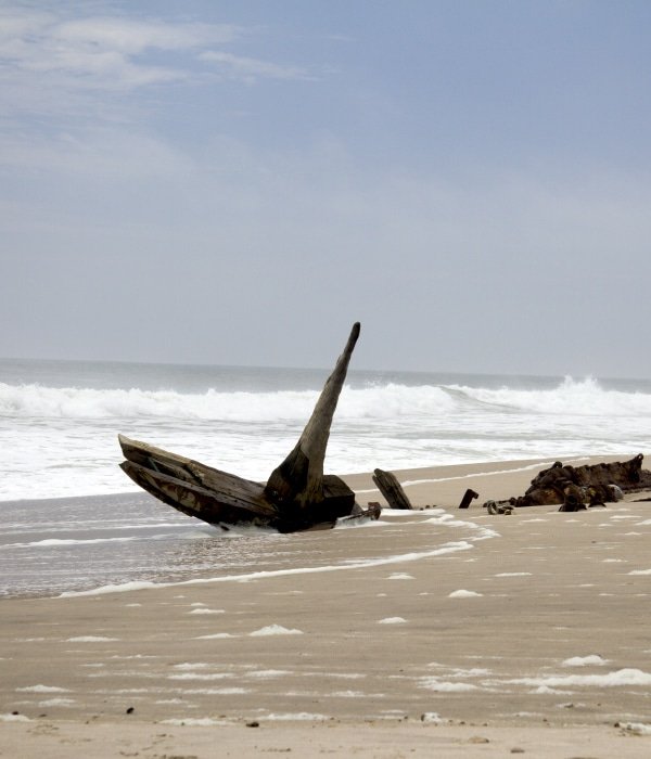
    Skeleton Coast The Skeleton Coast is located in the northern part of the Atlantic coast of Namibia and starts just north of Swakopmund. When the cold waters of the Atlantic Benguela current collide with the hot and dry air of the Namib Desert, a thick and dense fog arises. This was the cause of many early explorers in ships to lose their bearings. Shipwrecking on the Namibian coast was common and was soon the site of the biggest ship graveyard in the world. Survivors of these shipwrecks who managed to swim through the heavy surf and reach the coast, still had to face the waterless, hostile coastal desert and would not survive very long either. Look out for Terrace Bay which is dominated by high sand dunes and is the most attractive stretch of the Skeleton Coast.

    Petrified Forest The name is a bit misleading as it is not exactly a forest which turned to stone, but rather an accumulation of enormous fossilised tree trunks that are about 280 million years old. Scientists discovered that these trunks hadn’t grown in today’s Namibia but were washed down a river in ancient times when one of the many Ice Ages ended on the Gondwana continent. They believe that there must have been a huge flood that carried the trunks along to where they lie today. Look out for some beautiful specimen of the Welwitschia Mirabilis in the area, which are often called a living fossil due to the fact that they can live for over 1 500 years.

    Kalahari Desert The Kalahari Desert is described as a semi-desert, as the annual precipitation it receives is between 100 and 650 mm. (Real deserts like the Namib Desert are defined by an annual precipitation not more than 50 mm). Thanks to the higher rainfall, the Kalahari boasts very diverse flora and fauna and as a result, large parts have been declared as natural conservation areas, e.g. the Kgalagadi Transfrontier Park, the Central Kalahari and the Okavango Delta. The Kalahari is also home to the San, who have been living in the area for approximately 60 000 years and who are astonishingly well-adapted to the harsh desert life and who, until recently, kept most of their traditional culture. They know about 1 000 different useful plants and are masters in hunting and tracking.

    Brandberg Mountain Brandberg Mountain translates into "fire mountain" - a name that speaks of the glowing colours that the setting sun paints onto the range as if it was on fire. Brandberg is Namibia's highest mountain (2 606 m) and famous for its numerous rock paintings made by the San (Bushmen), which date back around 2 000 to 4 000 years. Apart from depictions of warriors or hunters, a large amount of different animal paintings can be found, which indicate that wildlife must have been abundant during that time.

Destinations in Namibia